NEOWISE-R is scanning ±92.5o from the Sun in
ecliptic longitude. This FORTRAN code
will compute the dates that a given position will be on the scan path.
Positions are entered in either celestial (RA,Dec) or ecliptic or
galactic (lat,long). For celestial type "C" means the input
is hh.mmss,dd.mmss while for type "D" the input is RA,Dec in decimal
degrees. Types E and G are also decimal degrees.
These dates can be off by one or two days depending on the Moon phase.
Example:
ned% ./NEOWISER-when
Enter Type(E/C/G),long,lat:C9.5542,+60.4026
(l,b) =  151.851  45.353
 9h55m42  60d40.4
(lambda,beta) =  125.936  44.374
 4/21/2014
10/30/2014
 4/22/2015
10/30/2015
 4/21/2016
10/29/2016
WISE generally observed a semi-circle at an ecliptic longitude
95o larger than the ecliptic longitude of the Sun (blue
curve below), and another semi-circle at an ecliptic longitude
90o smaller than the ecliptic longitude of the Sun (red
curve below). The asymmetry allows WISE to recover from a brief safing
event by decreasing the ecliptic longitude of the scan circles by
1o per day of duration for the safing event. This does not
cause WISE to scan any closer to the Sun.
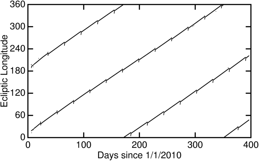
It should be possible to find the dates a source was observed by computing its ecliptic longitude, adding a ±0.4o/cos(latitude) range, and then finding the date(s) when the above curves are in the source's ecliptic longitude range.
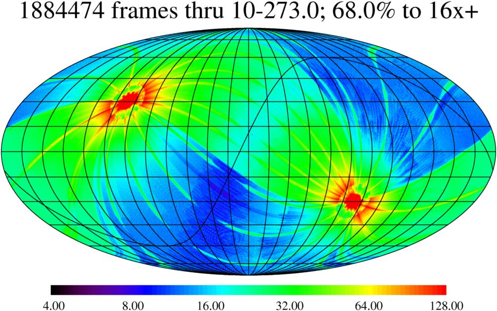
The map below shows the actual survey plus pretty good IOC coverage
in galactic coordinates:
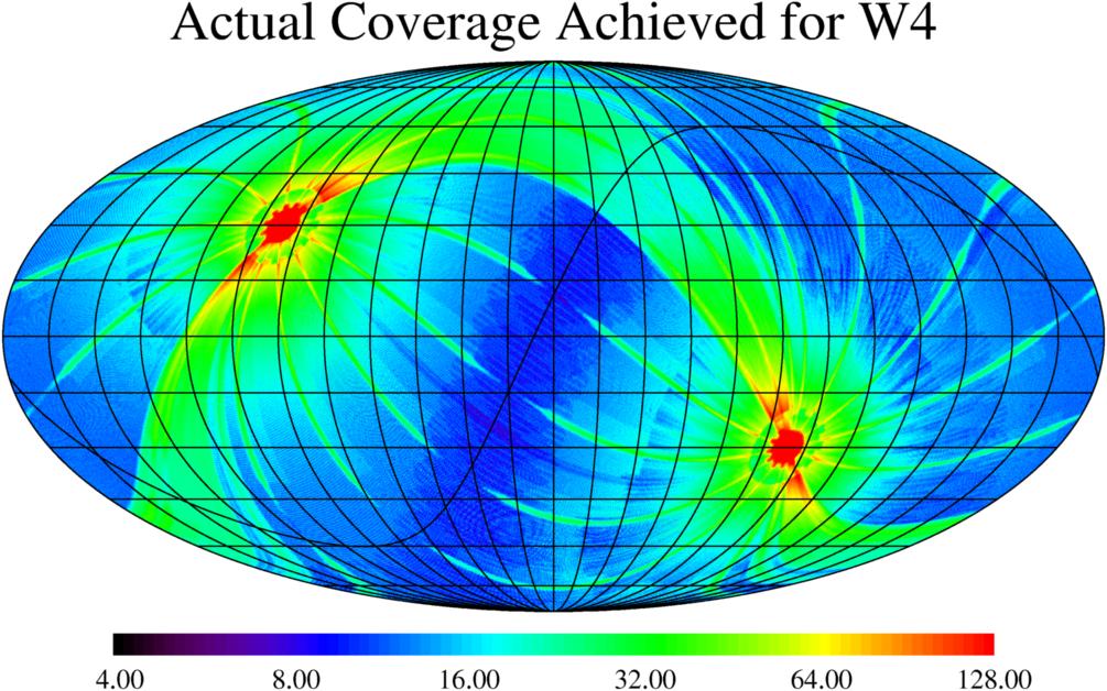
The actual coverage achieved in WISE band 4 (22 μm) is shown in the
map below:
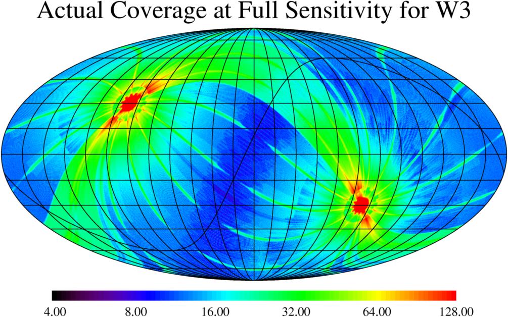
The actual coverage achieved in WISE band 3 (12 μm) before the increased
backgrounds from the telescope warming to 45 K required a reduction in
exposure time is shown in the map below:
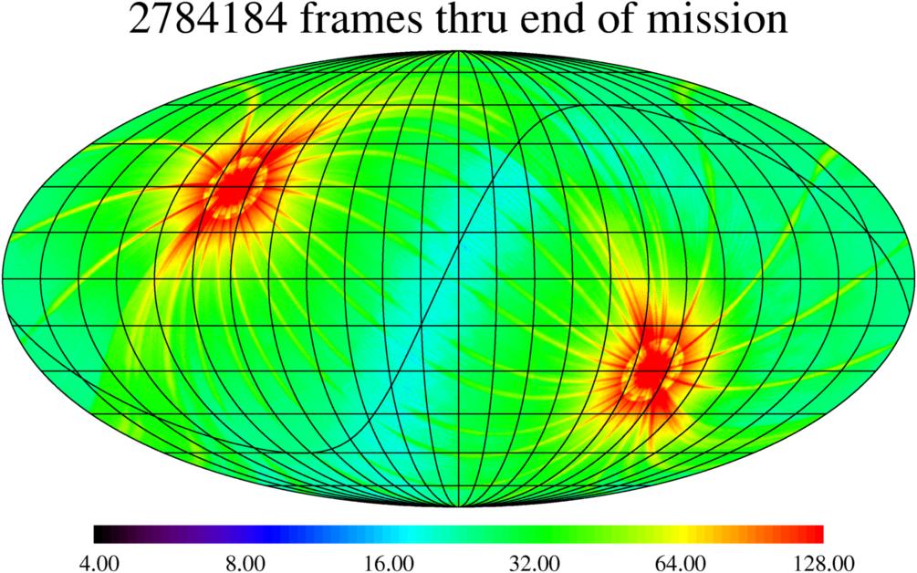
The full coverage for the cryogenic mission is shown in the map below.
Data continued to be collected in bands 1 and 2 for the NEOWISE asteroid
search program but this map shows the extent of the final data release
due in 17 months (01 Mar 2012 [TBD]):